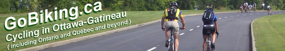
P’tit train du Nord
Cycle the Laurentians on the
“P’tit train du Nord” trail
(Scroll down to the bottom the this page for map and photos.)
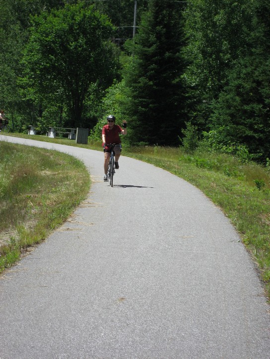
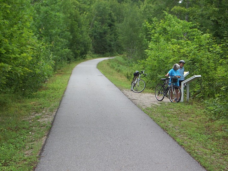
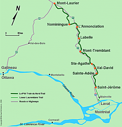
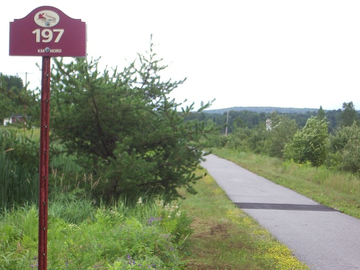
The P’tit train du Nord is a 200 kilometre bicycle Trail which runs through the Laurentians north of Montréal. It is an easy-to-ride trail that offers some spectacular scenery and that is lined with a good assortment of tourist facilities. It has to rate as one of the very best bicycle trails in this corner of North America.
The “P’tit train du Nord” literally means the “Little Train of the North”, and the trail is built on an old railway line which closed in the late 1980s. This means this trail is relatively flat. There are a few long gradual slopes to either climb or descend, but these should not be much of a challenge for most people, even those who may only cycle occasionally. The lack of hills on this trail is even more impressive considering that it winds its way through the Laurentian Mountains.
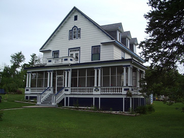
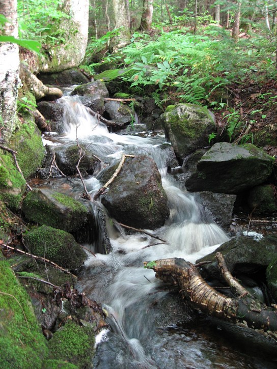
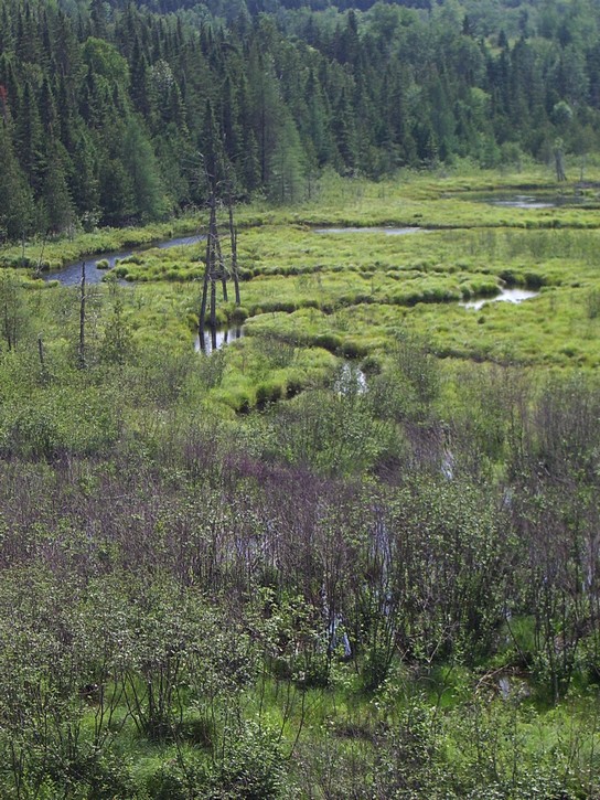
Converting abandoned railroad line into bicycle paths has become increasingly popular in recent decades. Unfortunately some of these trails can be a little monotonous because they are often laid out in straight lines and run through open fields or industrial parks in the backside or towns. But it’s usually the opposite with the P’tit train du Nord. In many areas, this trail curves around rivers, lakes, and the base of mountains. More importantly, the trail benefits from the entire tourist infrastructure that developed when the train used to bring thousands of people into the Laurentians for summer vacations and winter skiing from the 1930s to the 1960s.

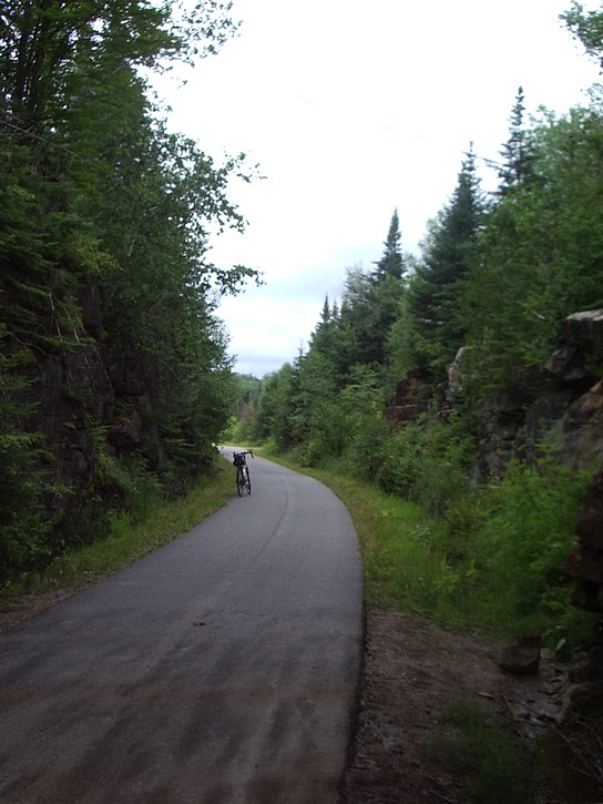
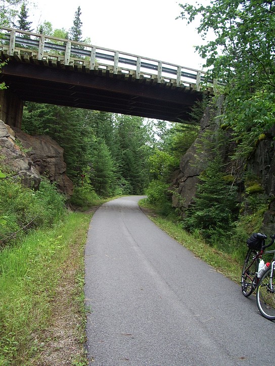
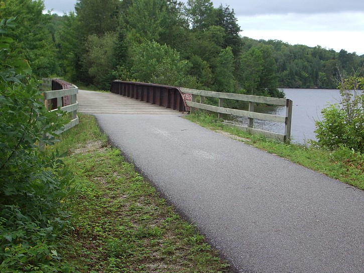
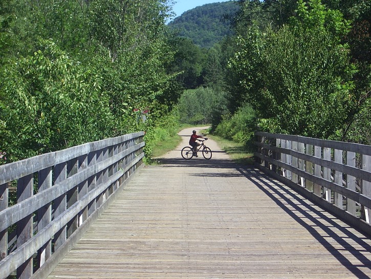
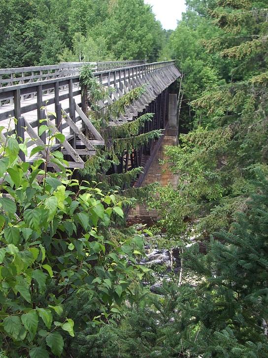
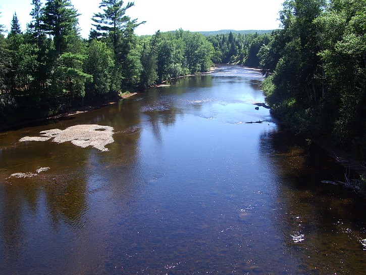
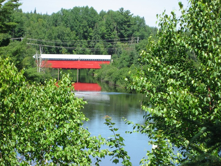
One of the many bridges on the 200 km P’tit train du Nord trail (scroll down for more photos).
The entire trail runs between Saint-Jérôme and Mont-Laurier for 200 kilometres in roughly a northwest direction. The northern portion of the trail (between Mont-Laurier & Labelle) has a nice paved surface. On this part of the trail, the towns are fewer and further apart, and the surroundings are a little more rustic, and perhaps a touch more scenic.
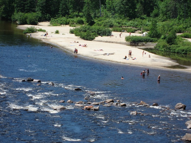
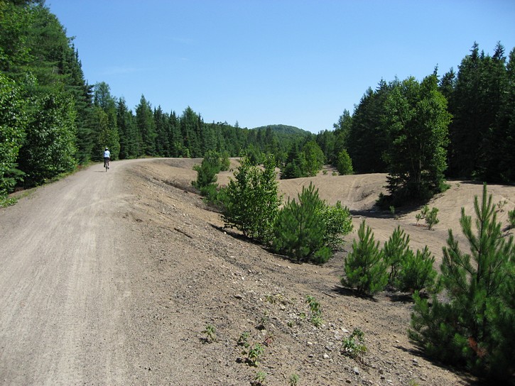
The southern portion of the trail (between Labelle & Saint-Jérôme) has a surface made of hard packed crushed stone. It can easily be ridden by all types of bikes, including those with narrow road tires (the author of this article had no problem using 700 x 28 tires ). This part of the trail tends to be a little more developed. It passes through more towns, has slightly more tourist facilities, and it runs along a number of cottage areas. Because of its proximity to Montréal, the southern part of trail may have a little more bicycle traffic, especially on weekends.
Planning a trip
There are a number of different ways of planning a trip on the P’tit train du Nord trail. Given that this trail doesn’t have any real hills, super fit cyclists that are used to very long rides could try to do all 200 kilometres in one day. Other experienced cyclists may be tempted to do it in two 100 kilometres segments, with one overnight stopover. However, such ambitious schedules would leave little time to take in the scenery or explore the nooks and crannies along the trail.
People who want to take it easy will often pedal the trail in four 50 kilometres segments, with three overnight stops. Such a timetable should leave plenty of time to stop for relaxing meals, to do a little exploring, and if it is hot enough, to take a quick dip in one of the rivers and streams which are often accessible from the trail. Fifty kilometre hops should be manageable for people who commute to work on their bikes or are used to pedalling reasonable distances on weekends.
Some people believe it is preferable to start in the north in Mont-Laurier and pedal “down” to Saint-Jérôme. This means moving in the same direction as the prevailing northwest winds. Moreover, on average, there is a slight downward slope over the trail’s 200 kilometre length when heading towards Saint-Jérôme. However, except in cases where there is a strong headwind, there is little difference riding the trail in one direction or the other.
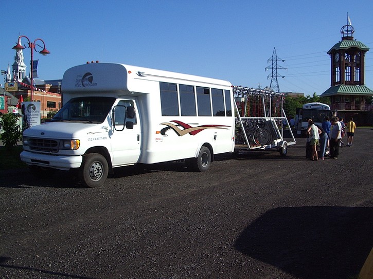
Regardless of which end people start from, there remains the question of how they will get back to their cars when they finish their ride. Obviously, people can pedal all the way back to where they started. An easier option would be to take advantage of the services offered by at least two businesses which operate shuttle buses with trailers that are especially designed for moving bicycles. For $40 (the price as of 2007), they will transport a cyclists and his or her bike and luggage from one end of the trail to the other.
They also offer additional services including providing assistance with trip planning and picking up and dropping off people and their bikes between various centres along the trail. This last service could prove handy for people who, for whatever reason (bad weather, sore knee) don’t feel up to pedalling a particular leg of their trip. For those who like to travel light on their bicycles, it is even possible to have one of the these shuttle bus companies transport their bags from one hotel to the next.
A typical itinerary
The following is a typical itinerary for riding the P’tit train du Nord in 50 kilometre increments.
The first step is to drive to Saint-Jérôme, a city of 70,000 just north of Montreal. The P’tit train du Nord starts at the old train station in the middle of town. It is one of the focal points of the downtown area, so it is fairly easy to find. When driving north on the Autoroute 15, take exit 43, head east for a few blocks on rue de Martigny Ouest, then turn right onto Labelle Boulevard, and then left on rue de la Gare. This leads to the beginning of the trail and a large parking lot where people can leave their vehicles while cycling.
After parking the car, many cyclists opt to take the shuttle bus to Mont-Laurier to start their ride at the northern end of the P’tit train du Nord. With this arrangement the car will be waiting for them in Saint-Jérôme when they come to the end of their 200 kilometre ride. It’s best to reserve a spot on the shuttle bus in advance. The bus usually leaves Saint-Jérôme between 8 and 9 in the morning, and deposits cyclists and their bikes in Mont-Laurier a little after 11 am.
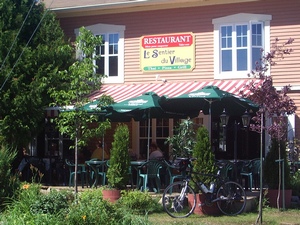
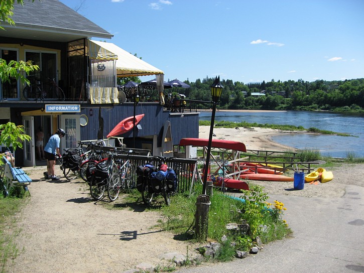
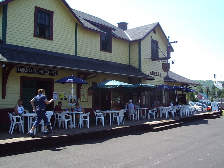
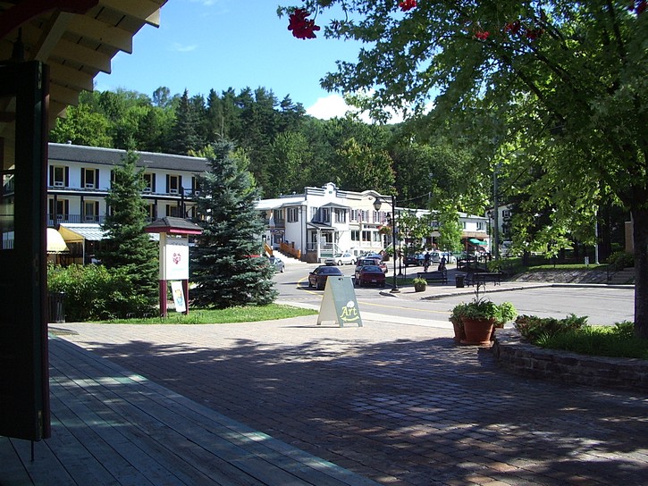
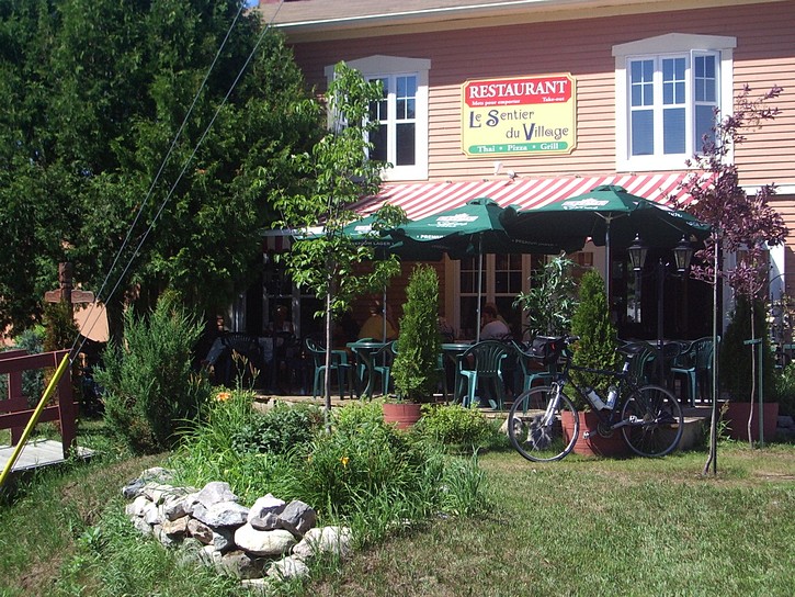
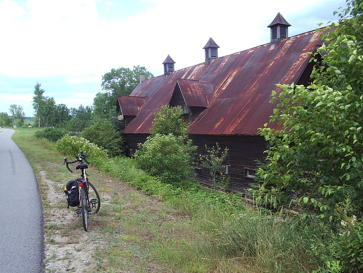
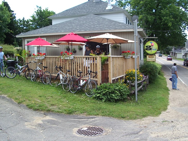
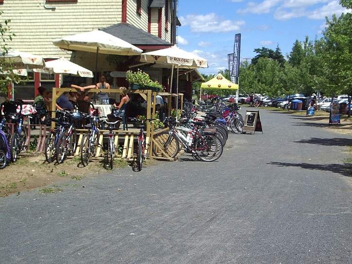
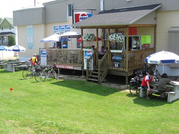
One of the many restaurants, patios, Inns, B&Bs, and campgrounds along the P’tit train du Nord trail.
Needless to say, it is easy to pick up any last minute snacks or other supplies at the IGA. If it is getting close to lunchtime, it is also possible to eat at several fast food restaurants within immediate walking distance of the parking lot. Another option would be to pedel down the trail for about 13 kilometres and eat at one of several restaurants in the small town of Lac-Des-Ecorces.
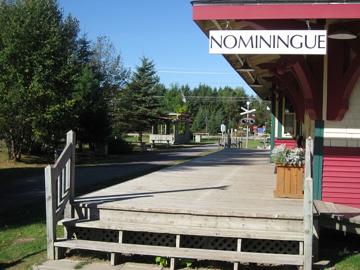
Nominingue is the first reasonably large community on the trail after Mont-Laurier, and it is therefore a good destination for the first day’s ride. It’s almost 60 kilometres from Mont-Laurier, meaning that it could be one longer rides when cycling P’tit train du Nord in four segments. However, this part of the trail has a nice paved surface, and many scenic views which ideal for rest stops.
Nominingue
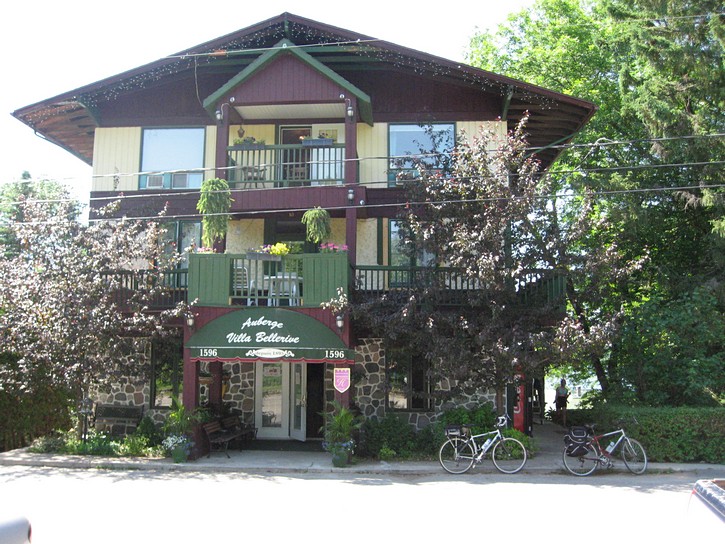
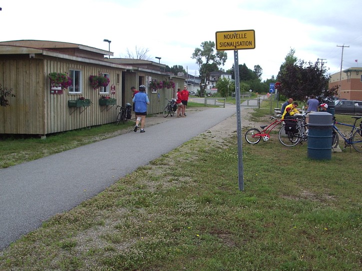
Nominingue is not as “touristy” as some of the towns further south, but it offers everything needed for a comfortable overnight stay, including a variety of hotels, bed & breakfasts, restaurants, bars, and stores. Its old train station has been converted into a tourist information centre and an exhibition area for local artists. There is a campground in Nominingue located on the left side of the trail a short distance before the old train station. In town le Provincialart is a nice bed & breakfast which caters to cyclists. Cyclists continuing on the trail for another 4 kilometres passed the old train station will find two charming Inns, the Auberge Villa Bellerive and the Auberge Chez Ignace. They are both located directly on the trail.
The following day cyclists will push on to Mont Tremblant, which is widely regarded as the half way point for the 200 kilometre trail. In the stretch immediately following Nominingue (and a few other areas), there are several places where the paved surface has developed a rippled or washboard effect. While these are never longer than a dozen metres, and are usually nothing more than a mild annoyance, they should be handled with care by anyone going fast on a heavily loaded touring bike.
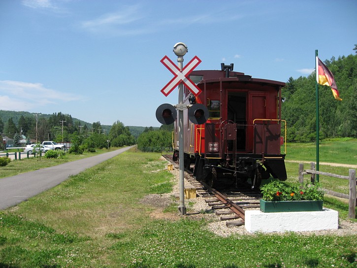
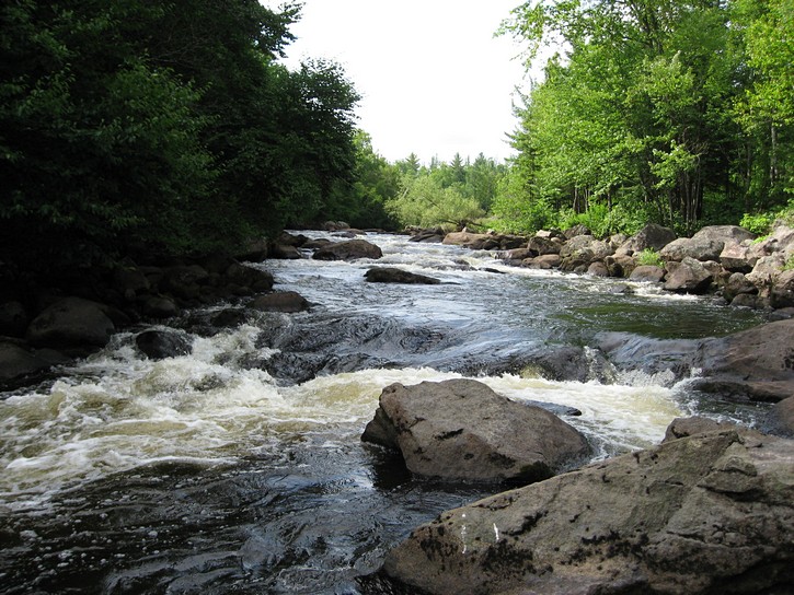
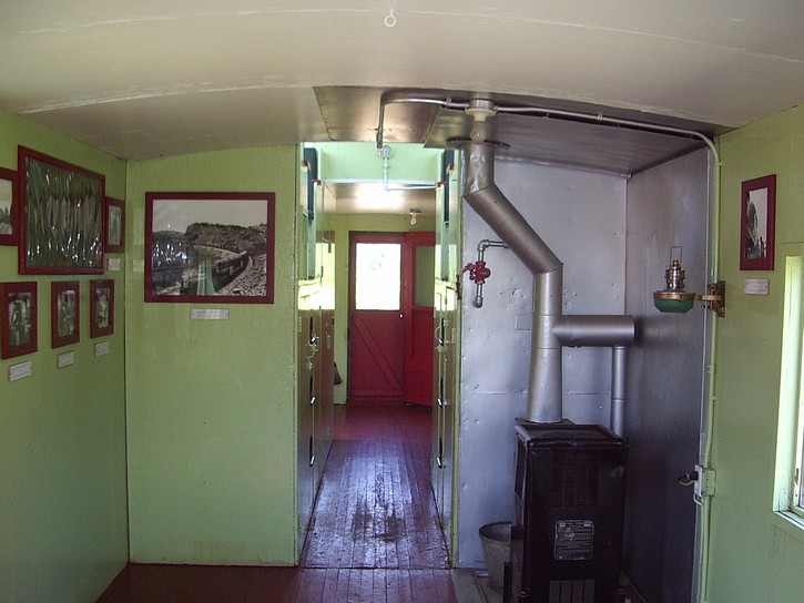
Cyclists leaving Nominingue early enough may want to consider stopping in the small town of Labelle for lunch. Labelle’s old train station houses a restaurant where people can enjoy a meal while watching the comings-and-goings along the trail. Across from the old station is a caboose which is now a small museum about the P’tit train du Nord when it was actually a railroad. Another option for lunch is the Kayak Café. It is only a few minutes away. To get to it, turn a right from the trail and go down the hill that leads to Labelle. At the bottom of the hill, turn left. It should then be possible to spot the Kayak Café in the distance. It has a nice terrace which overlooks the Rouge River. Under the restaurant is a rental outlet for kayaks and canoes.
Labelle is also the place where the trail’s surface changes to crushed stone. By comparison, the paved surface may seem a little more luxurious, but hard packed crushed stone is fairly easy to ride on. The main disadvantage is that bicycles and equipment tend to get dusty, especially if the weather has been dry for a while.
Mont Tremblant
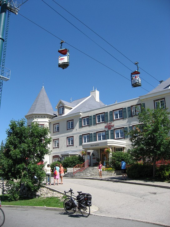
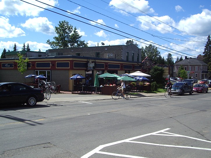
Mont Tremblant is the next stop, and it is only 16 kilometres further down the trail. The P’tit train du Nord passes next to Mercier Lake and what was the original town of Mont Tremblant. This area is touristy and quite busy. Like many other places on the trail, the town’s old train station has been converted into a tourist information centre and exhibition space for local artists. Although small, the original town of Mont Tremblant has much to offer cyclists stopping for an overnight stay. This includes grocery stores, bicycle shops, pubs, restaurants, a youth hostel, bed & breakfasts, and two fairly large hotels/motels (the Hotel Mont Tremblant and La Porte Rouge). All this is located right next to, or within easy walking distance of the trail.
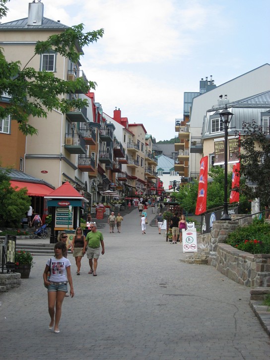
Cyclists who have had their fill of authentic little towns and quaint bed & breakfasts may be ready to indulge in some crass commercialism at the nearby Mont Tremblant Resort Village. It is the eastern equivalent to the Whistler Resort on the west coast, and it offers a Disneyland-like recreation of an alpine town. Although built to be next to the large ski hills, it operates as a year round resort. It is big, busy, and somewhat expensive. Needless to say, it is overflowing with specialty boutiques, stores, hotels, restaurants, and, of course, tourists.
The resort village is about 6 or 7 kilometres from the trail. The two are connected by a nice paved bicycle path, which starts next to the Post Office in the original town of Mont Tremblant. It should be noted that there are a few hills on this bicycle path. Nothing too serious, but steeper than anything on the P’tit train du Nord.
There is a central agency for booking accommodations at the resort, but people may want to consider the Marriott Residence Inn (if a room is available at a reasonable rate). It has a place to lock up bikes indoors, and the price of the room includes a truly impressive all-you-can-eat breakfast buffet. It can provide cyclists with enough fuel to pedal for the better part of a day, although the crowd around the buffet counter can sometimes resemble a war zone.
The next day, cyclists will head down the trail to either Sainte-Agathe-des-Monts or Val-David. Shortly after passing Saint-Jovite, it is necessary to start climbing a long slope. This slope is not very steep, but it is noticeable because it runs for about 8 kilometres. In terms of physical effort, this is the most demanding part of the P’tit train du Nord. Individuals who are not used to this kind of cycling may want to schedule a few rest stops on the way.
If pedalling up the long slope gives anyone hunger pains, it may be worth stopping at Saint-Faustin-Lac-Carré for a meal. The Stazione Restaurant is next to the trail and is a popular place to have lunch with cyclists. Opposite the Sorbet is a surprisingly large grocery store where it is possible to stock up on cold bottled water. There is also a park along the trail in this area, and the town’s old train station has public washrooms.
The long climb up the slope comes to an end at the summit just a little over a kilometre past Saint-Faustin-Lac-Carré. There is a sign announcing the summit at an altitude of 426 metres. From this point onwards, it is all down hill for the rest of the P’tit train du Nord.
The area between the summit and Sainte-Agathe-des-Monts is probably the most boring part of the 200 kilometre trail. It often follows a noisy four lane highway, and sometimes parallels a roadside industrial park, complete with construction depots and heavy equipment outlets. It is not that this segment of the trail is all that bad, but it doesn’t compare favourably to the rest of the P’tit train du Nord.
Sainte-Agathe
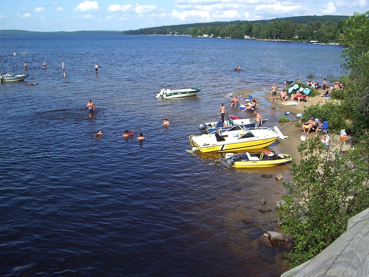
Sainte-Agathe-des-Monts is a fairly large centre in the Laurentians – almost a mini city. It is an attractive town with an interesting downtown area which offers a wide variety of facilities, including a good number of restaurants, bar, and terraces. There is sometimes free entertainment in the Lagny Park near the water front at the end of main street (rue Principale). Many of the town’s inns and bed & breakfasts are located along the shore of Lac des Sables such as Auberge du Lac des Sables and the Auberge de la tour du Lac. The P’tit train du Nord runs by the outskirts of Sainte-Agathe-des-Monts, but it only takes a few minutes to get to the downtown core by bike. Like many other places, maps and tourist information is available at the old train station.
|
Updates – There has been a few changes with Le P’tit Train du Nord trail since this article was originally written. |
From Sainte-Agathe-des-Monts it is only another 7 kilometres to Val-David, which is worth considering as an alternative destination. This is an attractive touristy little town that is renowned for its artists. Needless to say, it comes fully equipped with boutiques, restaurants, bars, terraces, inns, and bed & breakfasts, including Le Creux du Vent and La Maison De Bavière. The latter is located next to small waterfalls on the Rivière du Nord. There is even a bicycle shop in town, and all this is within visual distance of the trail. By going just a little out of town, it is possible to find even more inns and resorts. For example, the Auberge du Vieux Foyer is a two kilometre ride from the trail on a road with a bike lane.
The distance between Val-David and Saint-Jérôme is well under 50 kilometres, and should be easy to ride in the final day on the P’tit train du Nord. On the way, cyclists will ride by Sainte-Adèle. This is another of the major tourist centres in the Laurentians, and has a lot to offer anyone who pedals into town. Unfortunately, the trail is somewhat removed from the downtown area, and getting into Sainte-Adèle involves a small uphill climb and getting past Autoroute 15. However, the town’s old train station is a very popular stopping point along the P’tit train du Nord. It houses a surprisingly well equipped bicycle shop as well as a nice restaurant which is an ideal place to grab lunch while watching the traffic on the trail.
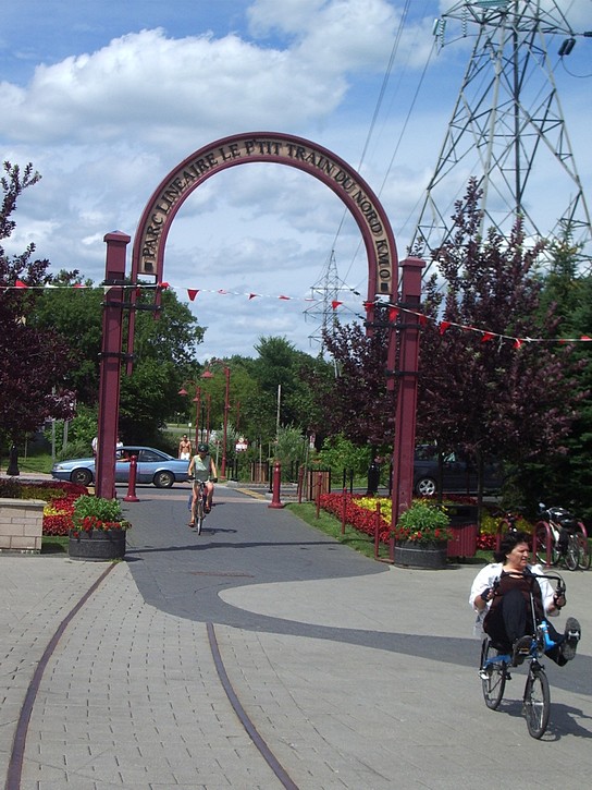
The P’tit train du Nord has a paved surface for the last few kilometres leading into Saint-Jérôme. Here the trail becomes an inner city bike path where parents teach their kids how to bicycle and neighbours stop for leisurely conversations. In this area it is best to go slow and be ready for pedestrian traffic. Cyclists come to the end of the trail when they pass under the P’tit train du Nord arch and enter a large plaza. There is even a relaxing terrace near the arch where people can sit down and order some celebratory drinks at the end of their journey.
The itinerary described in this article is fairly popular for people wanting to ride the trail in daily segments of 50 kilometres. But there are many other options for organizing trips on the P’tit train du Nord, and this job will be made all the much easier with a small booklet that is published every year. It provides a number of maps and gives a kilometre by kilometre listing of restaurants, inns, bed & breakfasts, campgrounds, and other services (but not all) that are available along the trail. It is easy to pick up a free copy of this booklet in French or English at many key centres on the P’tit train du Nord. A web page version of this booklet is also available.
It’s also worth noting that there exists a series of bicycle paths and trails that make it reasonably easy to cycle to the P’tit train du Nord from Montréal. This involves making use of Québec’s “Route Verte” network of bicycle lanes, paths, and trails to cross Montréal and the sprawling suburb community of Laval. From here cyclists will head to the “Parc Lineaire des Basses Laurentides” an 18 kilometre trail which runs from Blainville to Saint-Jérôme. The only problem with this route is that there are a few gaps, mainly between Laval and Blainville, where cyclists will have to ride on fairly busy streets. It is also possible to get lost in a few spots, so it is necessary to use a good map and do some careful planning.
The P’tit train du Nord is an ideal choice for anyone who ever considered a thoroughly enjoyable bicycle vacation. It brings together all ingredients necessary to plan for a great cycling trip.
Michael McGoldrick,
September, 2007
![]()
![]()
![]()
![]()
![]()
![]()
Some handy links for this ride:
► Official web site of the “P’tit train du Nord” |
(Click on the map for a larger version.)
(Click on the images for larger photos)

.")